Bethlehem, December 5, 2012: Researcher Saher AlKhouri of the Applied Research Institute Jerusalem ( ARIJ ) have successfully devolved a cartography monthly climate archive for the Occupied Palestinian territories covering the period of 2000 – 2010. An archive that would help in monitoring and control of further environmental degradations.
Cartography monthly climate archive explored layers modeling 11 years of mean maximum, mean and mean minimum air temperature in Celsius degree and of total precipitation in millimeter for the occupied Palestinian territory (oPt) for the era covering 2000 – 2010, using the ANUSPLIN interpolation process.
This archive is based on research carried out at the Department of Desertification and Geo-ecology by Mr. Alkhouri at the Estación Experimental de Zonas Áridas (EEZA), Consejo Superior de Investigaciones Científicas (CSIC) in Almería, Spain, under the supervision of Dr. Gabriel del Barrio Escribano.
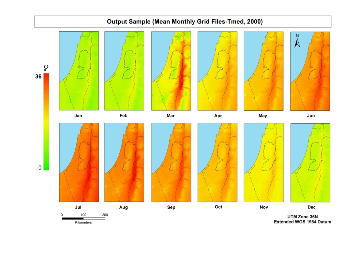
Mean temperature 12 months 2000
Mr. AlKhouri was able to successfully construct this archive during the era October 2011 and September 2012 based on his research that has conducted while delivering his publicized theses on Monitoring of Land Condition in the oPt 2000 – 2010 .
The main results of research mentioned was the of the climate archive consisting of 528 raster grid files (11 years * 12 months * 4 variables), with 250 meter resolution from January 2000 to December 2010. The monthly grid files were interpolated within a working window which extends over the Occupied Palestinian Territory and Israel in order to include as many meteorological stations as possible.
The monthly climate archive can be used to provide the Palestinian researchers and various other stakeholders with narrative and cartographic description for the climate in the occupied Palestinian territory during the study period (2000-2010). Which helps to monitor and control further environment degradation and carry out many different researches including and not limited to research that investigates the climate change, land degradation and desertification, environment decision making and conservation of the Palestinian natural resources, etc.
“Creating this archive is to be considered of a one step closer to achieve Environmental Information System (EIS) for Palestine using remote sensing & GIS as a main tools” Concluded Mr. Alkhouri.