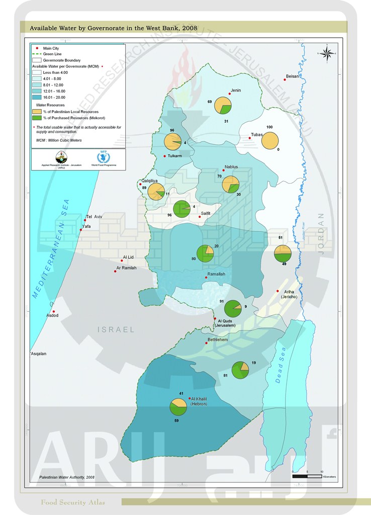
Available Water by Governorate in West Bank 2008
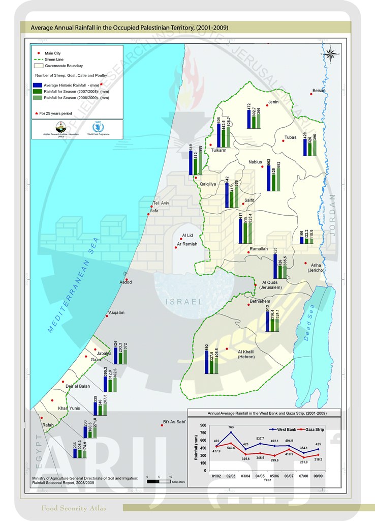
Average Annual Rainfall in the Occupied Palestinian Territory (2001-2009)
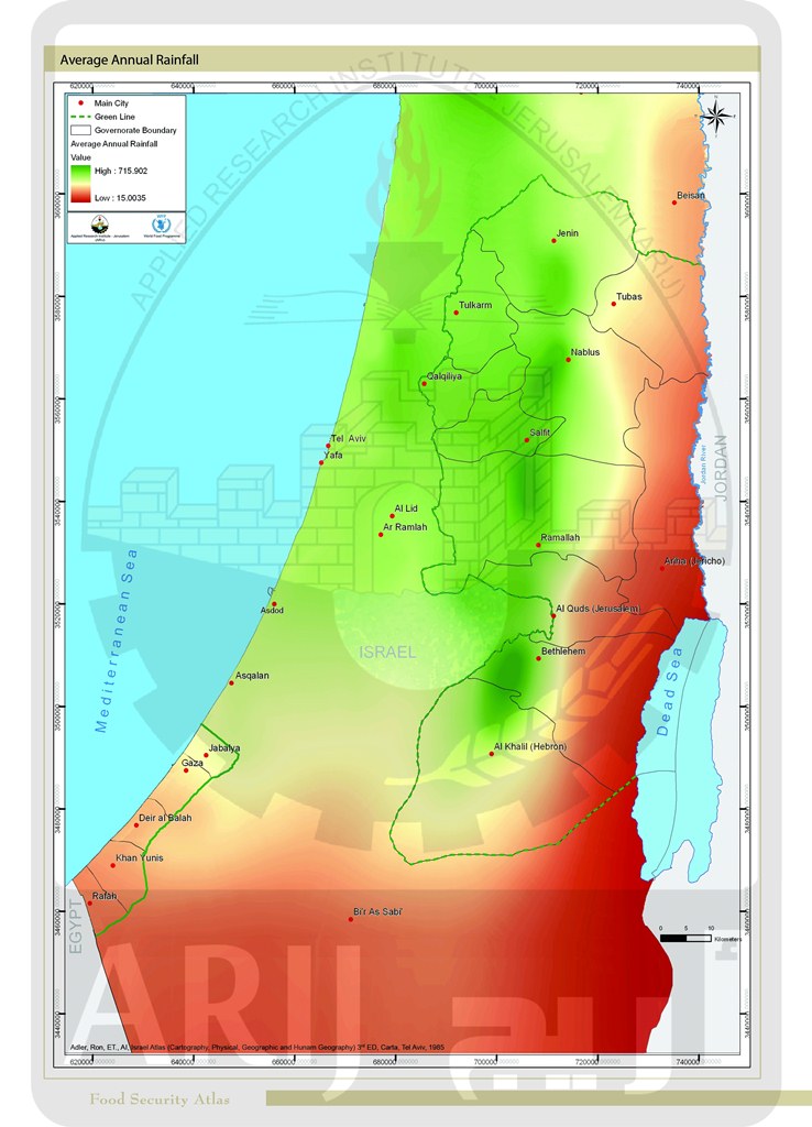
Average Annual Rainfall

Connection to Wastewater Network by Village Boundary 2007
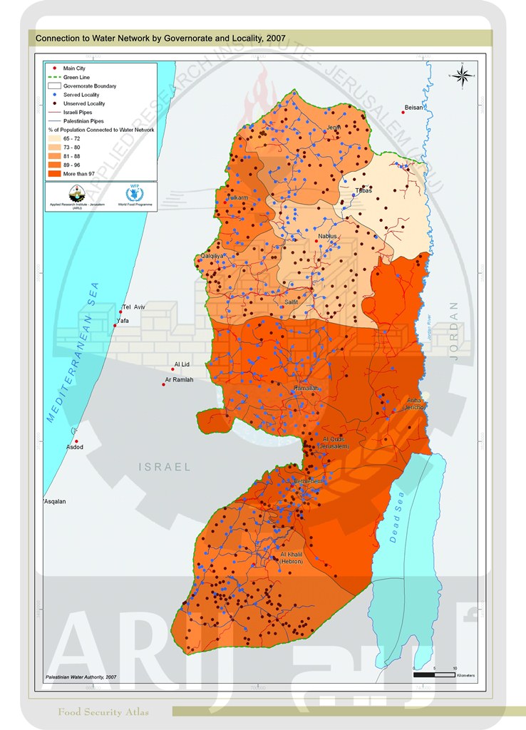
Connection to Water Network by Governorate and Locality 2007

Daily Per Capita Domestic Water Supply by Governorate in The West Bank 2008
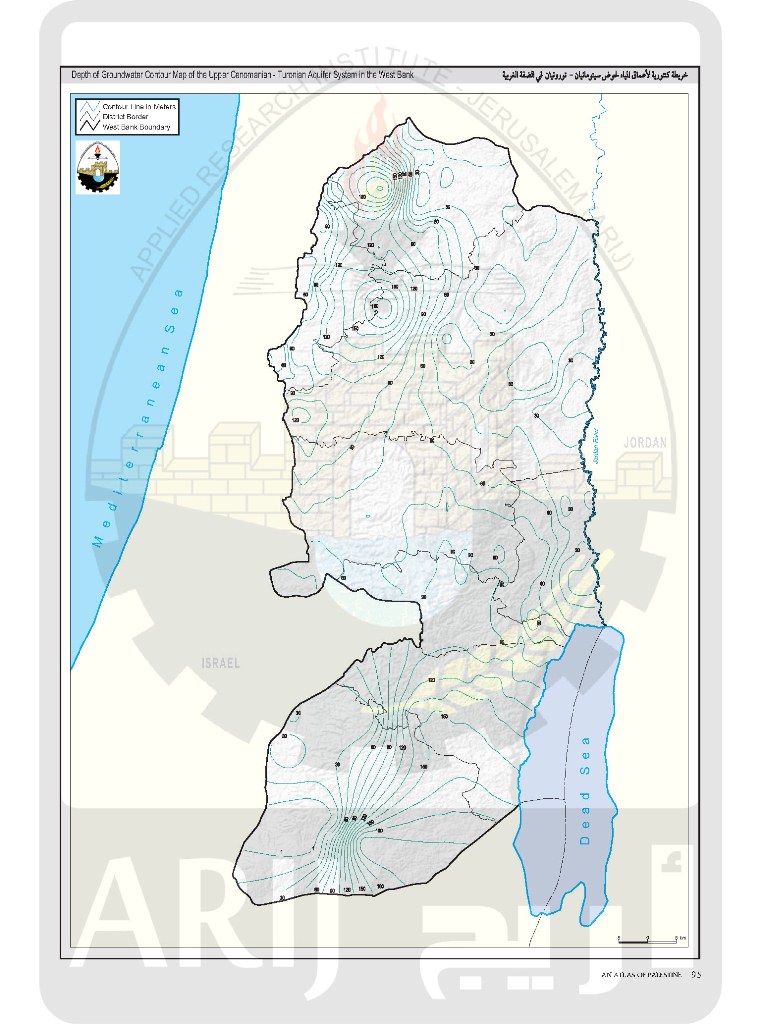
Depth of Groundwater Contour Map of the Upper Cenomanian-Turonian Aquifer System in the West Bank